There are things you know, things you don’t know, and things you’ll never know. That’s one of the immutable laws of science.
But occasionally, some of the things you thought you’d never know get answered if you ask the right question, use the right tools, and look in the right place. That turns everything on its head, and everything you thought you knew deserves another look.
That’s what’s happening with a group of international scientists. They’ve spent years exploring the world’s oceans in a massive effort to study the world’s marine ecosystems. At the very heart of it is an attempt to fundamentally change the way marine biologists study the oceans.
The project, the Census of Marine Life (CoML), is a survey of the biodiversity of the world’s oceans. Dubbed “unprecedented” and “astounding” by the scientific community, CoML is a 10-year, nearly $1 billion effort by nearly 300 scientists from 53 countries. CoML scientists are trying to count how many species inhabit the 70 percent of the world that’s so scantily surveyed that it might as well be on another planet. They hope to quantify how those species are distributed around the world, gain a rough estimate of their total numbers, and map where they are concentrated while plotting a course for ocean study for decades into the future. And they’re seeing the darkest corners of the ocean in a whole new light.
“By the end of the 10-year census initiative, we expect several results,” says Jesse Ausubel, program director of CoML for the Alfred P. Sloan Foundation, one of the primary funding sources for the census. “We will have identified many new species and will know with far greater precision how many remain undiscovered. We will know better whether the size spectrum of animals in the ocean is changing: Are small animals replacing the large? We will know better how changes in the abundance of ocean life are shifting among major groups: Are jellies replacing fishes? And we will know much better what we do not know: identifying the unexplored.”
Not as Easy as 1, 2, 3
For as much space as oceans occupy, marine biology research is decades behind terrestrial research. In fact, less than 5 percent of the oceans have been scientifically sampled. The biggest obstacle to that research is that fish and other marine animals are darned hard to count — and that data is even harder to compare. The technological hurdles of poking around in the ocean make any project look more like a Gallup poll than a thorough “census.”
Say a scientist wants to study a bay along the coast of California. “Historically, people have gone out in a little bay and sampled all things in the ecosystem,” says CoML Senior Scientist Ron O’Dor. “This eats this, so this is how it works.”
However, asks O’Dor, what happens five years later when offshore currents move closer to shore, changing the amount of plankton that blooms in the bay? What happens if the temperature of the bay changes by a few degrees, or flushes more frequently with new ocean water? In different environmental conditions, different species flourish (that “reserve capacity” is why rich biodiversity is important, by the way); today’s keystone reef grazer may be tomorrow’s rare sighting, and vice versa. Put that way, those are big “dunnos” — they don’t even give scientists enough room to hypothesize, O’Dor says.
CoML asks three deceivingly simple questions: What lived in the oceans, what lives in the oceans now, and what can we expect will live in the oceans? The rubber hits the road when its scientists talk about how they’ll answer them — with a variety of number-crunching analytical tools and whiz-bang field research techniques. To make the project work, scientists are doing a coordinated effort, using new tools, and keeping an eye out for how we’ll use this data in the future.
From a marine biologist’s point of view, this is the dawning of a new age of Aquarius. CoML’s analytical methods include mining records that show how many fish have been caught, developing Internet-based databases and maps of ocean species and their distributions, and designing computer models that can predict species populations based on ocean conditions. In the process, it’s creating some unusual bedfellows. Teams of historians, anthropologists, paleo-oceanographers, and biologists are working together on the History of Marine Animal Populations (HMAP) project to extract population numbers from fishing records, tax and tithe records, ships’ logs, and ocean sediment cores, then putting them into a form biologists can use.
While historical information is available for commercial fisheries, current sources of data aren’t always so forthcoming. Scientists tend to closely guard their research data — the fish counts, dive results, or reef surveys they’ve spent time, energy, and hard-fought grant money to collect. Other scientists usually see only the results, analyzed, digested, pureed, and published in scientific journals. Practically speaking, a researcher studying sea anemone distribution in the Caribbean is unlikely to know the same kinds of data for anemones in the Pacific unless he or she also is participating in a study there. “We’ve got maps of biodiversity for several species, but no one’s got a global picture,” O’Dor says.
Another tool CoML has developed is changing that. The Ocean Biogeographic Information System (OBIS) is a set of international online databases of marine creatures, where scientists are encouraged to share their data. OBIS is the grand prize for playing along with the CoML project. All the past, present, and future data will be entered in the same format that can be plotted on digital maps, along with satellite plankton blooms, ocean temperatures, and currents. CoML planners adopted this “standardized” practice from the oceanography community, which has shared data for years. This storehouse will drive the data-hungry computer models, developed by CoML’s Future of Marine Animal Populations (FMAP) team that use thousands of calculations to predict population sizes. If all this sounds like egg-headed techno hoo-ha, it is. But something as simple as a common format or research protocol — speaking the same scientific language, if you will — is essential for comparing apples to apples.
Data is already pouring into OBIS — much of it from early proof-of-concept projects to determine if a global ocean census would actually work. CoML is revving up to run nearly six years of field projects in six different ocean realms, using the latest ocean-mapping and fish-counting technologies.
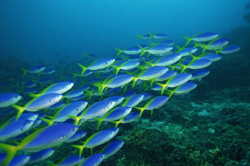
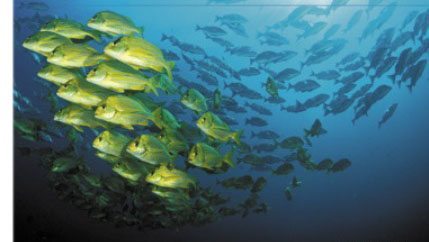
 Red Fish, Blue Fish
Taken as a whole, CoML’s six realms offer a slice of the entire ocean, from “The Human Edges,” the near-shore and coastal areas that most people are familiar with, to “The Hidden Boundaries” of continental margins and abyssal plains thousands of feet below the surface. In between, teams are studying the Light (shallow) and Dark (deep) zones of the Central Waters realm and the biogeography of ocean floor vents of the Active Geology realm. All told, seven field projects are under way to explore them. The data scientists collect over the next five years will be the baseline data to test how management techniques, climate change, pollution, and run-of-the-mill variability affect ocean life for years to come. “By 2010, we’ll have demonstrated efficient technologies that will be adopted by the people who monitor the oceans,” O’Dor says.
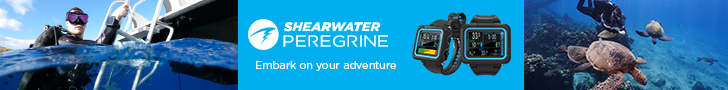
Natural Geography in Shore Areas (NaGISA). While the nearshore — tidal areas less than 20 meters (66 feet) deep — is only about 2 percent of the ocean’s area, it’s home to more than 60 percent of the known marine species. It’s also the first ecosystem hit by pollution, coastal development, and other human perturbations. NaGISA, a Japanese word that describes the narrow tidal zone where land meets the sea, will study delicate tidal algae and seagrass communities in this realm. NaGISA’s protocols are intentionally low-tech, so even poor countries can provide data. Researchers have divided coastal areas around the world into 20-degree-latitude-by-20-degree-longitude “boxes” from the Arctic to Antarctic and along the equator. They’re sampling three different sites at three different regions in each box, which is roughly the size of Alaska. Local researchers observe, photograph, and collect marine invertebrates, estimate the amount of cover from species of algae, sample seagrass beds, and measure water temperatures, both at the surface and at depth.
Gulf of Maine (GoMA). Hosted by the University of Southern Maine, GoMA scientists are gathering knowledge they hope will eventually allow them to attempt “ecosystem management” on a large scale. Unlike tweaking fisheries for a single species, say, cod or crab, ecosystem-based management considers the interrelationships between every species in the habitat that’s necessary to make it function properly, from plankton to whales. Considering there are more than 300 years of catch records for the region, scientists will be able to plot long-term trends of once-huge fisheries that have since dried up. It’s potentially the mother of all gold mines of data.
Since early 2003, GoMA scientists have used acoustic sensors and cameras on U.S. and Canadian research vessels, sleds, ROVs, and buoys to “collect” species. Sonar fish-finders measure fish concentrations and behaviors, including their position in the water column, their daily movements, and their seasonal migrations. Laser Optical Plankton Counters record images of plankton that a computer interprets and logs as particular species, and Video Plankton Recorders provide microscopic motion video of copepods, jellyfish, worms, as well as the larval forms of starfish, barnacles, and crabs, which are also classified automatically by a computer “eye.” Scientists will superimpose those results on physical data about the Gulf, including currents, salinity, temperature, color, and turbidity to compare fish locations with water conditions and food sources.
Pacific Ocean Shelf Tracking (POST). Once salmon leave the rivers of the Pacific Northwest, scientists know almost nothing about how the little fish grow into big ones. To learn more, scientists are building a permanent sonar system to track young Pacific salmon along the west coast of North America. Researchers want to know where they go, how they get there, and why so few return to spawn — depending on the species and the stock (where they came from), between 0.5 percent and 20 percent of juveniles return to breed. The project involves implanting small tags in the bellies of juveniles caught in rivers. Archival tags will record and store information on temperature, depth, and light levels, allowing researchers to literally read the fish’s biography since it was implanted, but the fish has to be caught for the data to be collected, a task that often requires sharp-eyed, cooperative fishermen. Instead, researchers are testing new acoustic “pingers” to track fish.
Their big idea is to stretch a series of overlapping receiver lines with up to 30 sensors each across the 20-kilometer-wide continental shelf from Baja, California, to Alaska. As tagged fish move along the shelf, the receivers “hear” their serial number and upload the hit to POST computers. This data will tell scientists critical information, such as whether fish of a feather — or at least those who grew up in the same riffle back in the river — swim together, how the fish react to different grazing conditions that result from weather fluctuations, and if there’s stock-specific, age-specific, or location-specific reasons for the variations in salmon death rates. They plan to install a pilot array this year and next, and then fill in the gaps as the technology proves itself.
Census of Diversity of Abyssal Marine Life (CeDAMar). The abyssal plains are the accumulation of eons of marine snow — particles living and not, falling through water and settling at the bottom of the oceans, in some places to 5 kilometers (3 miles) deep — that are dotted with hard nodules of manganese, iron, and copper that decompose to feed bacteria. The seafloor has been explored by undersea miners but very few biologists. Scientists from CeDAMar are studying these “hyperbenthic” regions by sampling along 1,000-kilometer-long (625-mile-long) transects on the sea floor. Underwater sledges and corers sample bottom sediment for specialized creatures, such as crustaceans, worms and algae, and cameras record the sea-floor structure and any larger animals that happen to be lolling about. Their data tracks the distributions of creatures in the seafloor communities to determine which of the 100,000 known species who live there are “common” or “rare” species and what they eat. They also hope to determine what causes variation in diversity — climate, latitude, sediment composition, or currents. Already, CeDAMar researchers are adding species to the catalog of life on Earth — which is exciting news if you’re a mollusk or nematode fan.
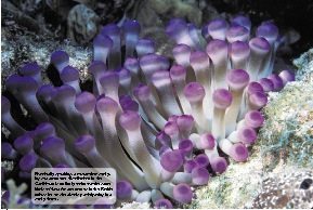
Tagging of Pacific Pelagics (TOPP). Back in the “dark ages” of only a few years ago, scientists pieced together the movements of mobile fish species from isolated geographical points — where researchers tagged fish, and where they were collected in nets, hundreds of miles away. They had no way of knowing how they got from Point A to Point Z. TOPP is designed to offer an “organism’s-eye view” of the ocean world, allowing scientists to track 17 different species of large, open-ocean animals, including albacore tuna, albatross, whales, elephant seals, white sharks, and turtles, as they travel around the globe.
The key to the project is small, microprocessor-controlled tags that record internal body temperature, pressure, light levels, and water temperature for months or even years. For mammals, the sensors also detect heart rate and swimming velocity. Some transmit data to oceanographic Argos satellites as the host animal surfaces to breathe. Others pop off the animal after a predetermined time to upload their information. The 4-year-old project is answering such big questions as where the animals go over the course of a season, how often and deep they dive, when they feed, and where they hunt.
Mid-Atlantic Ridge Ecosystem (MAR-ECO). About 3,000 meters (9,900 feet) below the surface of the Atlantic, from the Azores to Iceland, is a range of undersea ridges and canyons. Scientists are exploring whether these ridges are a stopping-off point as marine species move across the ocean, or if underwater currents “pin” them to their specific structure, creating many miniecosystems of fish, crustaceans, cephalopods, and jellyfish. Because of their fragile bodies, many creatures from these depths are damaged by trawling nets that collect research samples, or from the monstrous pressure changes on the way to the surface, so scientists have to go to them in deep-sea submersibles. In doing so, they can also see where on the ridge the different species are found, and what other animals live nearby. Underwater MAR-ECO video from one dive, more than 2.5 miles (4 km) below the mid-Atlantic in the Charlie-Gibbs Fracture Zone, shows surprisingly rich coral and sponge formations in the deep seas worldwide — dispelling the assumption that the deep sea was mostly mud. Some MAR-ECO research also suggests that between 15 percent and 40 percent of the species collected on seamounts are new to science and likely found nowhere else.
Chemosynthetic Ecosystems (ChEss). Hydrothermal vents receive no sunlight, yet are home to thousands of species of sea life. Water enriched with sulfur and other minerals exits mounds on the seafloor at nearly 350 degrees Celsius in thick, dark clouds called “smokers” to feed bacteria on the bottom of the food chain. Similar ecosystems occur in other oxygen-deficient regions, including on the sunken carcasses of large animals, such as whales, on the wood of sunken ships, and along “cold seeps,” areas where methane and sulfide leech out of the sediment. Incidentally, vents were only discovered in 1977, and scientists have only known about cold seeps since 1983. Since then, more than 700 species have been described from these ecosystems.
Researchers are using deep-sea submersibles and ROVs to locate, map, and sample new chemosynthetic systems along the Equatorial Belt, from Costa Rica to Africa, and in the southeastern Pacific, along the coast of Chile, under an important migratory route for whales. Surveys are also planned near New Zealand, a rich depository of vents, and in the sea between Norway and Greenland. Results from these studies could show these vents are an undersea Galapagos Islands, where future Darwins can explore isolation, evolution, and dispersal — far from the effect of human activity. Even more exciting is the notion that geothermal vents may have been the source of the origin of life on Earth. This could provide NASA astronauts and astronomers with important clues for the study of Mars and other planets.
 Results Aplenty
In their preliminary report released last October, CoML scientists previewed the fruits of their labor. Ranging from historical trends to marine animal behavior patterns to new discoveries in each of the six realms, the results show the project is already paying off.
By 1600, the level of fishing in Northern Europe had already heavily affected the ecosystem, HMAP researchers say. Seven of the major types of carnivores, herbivores, and coral species found on reefs were already declining in 14 regions, first in the Atlantic then in the Red Sea and Australia. The rate decline is markedly similar worldwide, researchers say. The first to go were the larger animals, then the small animals and other species. Well before the turn of the 20th century, the European gray whale had been hunted to extinction and the herring catch peaked at nearly 400,000 tons a year. Over the past 50 years, every species of large wild fish has been caught so extensively that 90 percent of each type has disappeared.
That’s the bad news.
The good news is that in its first three years, CoML researchers have identified about 160 new fish species each year, or about three a week, and an average of 1,700 other animals and plant species per year has also been cataloged. For those of you keeping score at home, we’re now up to about 15,304 fish species and between 194,696 and 214,696 species of animals and plants. By 2010, O’Dor and his colleagues may have discovered 5,000 new fishes and more than 2 million other life-forms.
They’ve also learned a massive amount about how fish use the ocean. MAR-ECO scientists suspect that fishes indigenous to one side of the Atlantic Ocean may be using extinct undersea volcanoes as steppingstones to migrate to the other side. Exploring the Bear Seamount, the westernmost underwater peak just off Georges Bank near the Gulf of Maine, scientists identified eight species of fish from the eastern Atlantic that were unknown in the western Atlantic.
Thus far, TOPP has tagged and tracked a handful of sharks, elephant seals, and turtles, and more than 1,000 bluefin tunas. Now TOPP is working on tagging another 4,000 animals. “We can now see the ‘hot spots’ for bluefin tuna in the Atlantic,” said Barbara Block, project co-leader for TOPP. “We’re discovering the migration corridors these animals are using to travel from place to place. We are recognizing that the tunas we see off the coast of the Carolinas in the winter might be at the Flemish Cap off Canada by spring, and all the way to the Mediterranean by summer. And then they’ll make the journey back by the end of that year to the western Atlantic close to the point where we tagged them. Piece by piece, we are assembling a picture of how these animals are using their environment.”
A study in the journal Nature published by the TOPP team revealed that white sharks roam vast stretches of the ocean. This contradicts many scientists’ assumptions that the sharks are exclusively coastal creatures — an assumption driven by studies that tracked them for only a few days at a time around seal colonies. Four of the tagged animals appeared near coastal seal rookeries just as young elephant seals arrive to rest before the annual mating ritual of adult seals, but they moved on soon afterward. Three of them moved for several months into the open ocean hundreds of miles offshore Baja, California. The fourth traveled more than 2,200 miles (3,520 km) to the waters off Hawaii, where it spent the entire winter and spring. Sharks also spend 90 percent of their time swimming at two depths — within 15 feet of the surface, and between 900 and 1,500 feet (300 and 500 m) down. TOPP has collected similar data for turtles and seals, as well.
This kind of information can protect these animals from inadvertent capture, collisions with vessels, or other harm — or even just provide them with refuge to create another generation of their own. In the North Pacific, for example, long-line fishermen inadvertently catch loggerhead sea turtles when fishing for swordfish — a situation that’s undesirable for both the turtles and the fishermen. TOPP data show that the turtles concentrate along the edges of warm-water masses in the ocean. Mapping the location and depth of these zones and how they move over the course of a day or season, helps identify turtle hot spots for fishermen to avoid — without having to close an entire fishery to protect an endangered species.
While they may never know all the answers to every question, CoML is showing that new approaches, technology and tools can teach scientists more than they ever expected to learn. And it will do it for years to come. Because every time we turn our knowledge of the ocean on its head, we get a better look at what’s below.
For More Information
Census of Marine Life (CoML): www.coml.org
Future of Marine Animal Populations (FMAP): http://fmap.dal.ca
Gulf of Maine Area Program (GoMA): www.usm.maine.edu/gulfofmaine-census
Mid-Atlantic Ridge Ecosystem Project (MAR-ECO): www.mar-eco.no
By Greg Laslo
Photos By Marty Snyderman